Hanging Moor 13 Sep 15
Results
Results and Splits
Splitsbrowser
BOF Ranking Points
Details
Claro will host a Level C Event at Hanging Moor, west of Harrogate on Sunday 13th September 2015.
| LOCATION | Hanging Moor |
|---|---|
| NEAREST POSTCODE | HG3 4BB |
| LATITUDE/LONGITUDE | 54.004744, -1.761191 |
| LINKS | Streetmap |
| OS GRID REFERENCE | SE 156 573 (Parking) SE 157 565 (Entrance) |
|
|
|
ENTRIES: Entry on the day only (EOD). SportIdent (SI) punching will be used for all courses. Hire dibbers will be available.
FEES: Senior £7, Junior £2.50, SI dibber hire £1 (Juniors 50p) , Car parking £1 per car.
DIRECTIONS: The area is approximately 10 miles west of Harrogate, just north of the A59. It will be signed from the A59 at the junction in Blubberhouses. Access is via a narrow lane (Hall Lane / West End Lane) to the Yorkshire Water access gate at Nethernooks Bridge (SE 157 565). From the gate, the parking area is a further 700m along a single lane gravel track. A one way system will operate: no exit before 1200 or entry after 1200. There will be a car park charge £1 per vehicle.
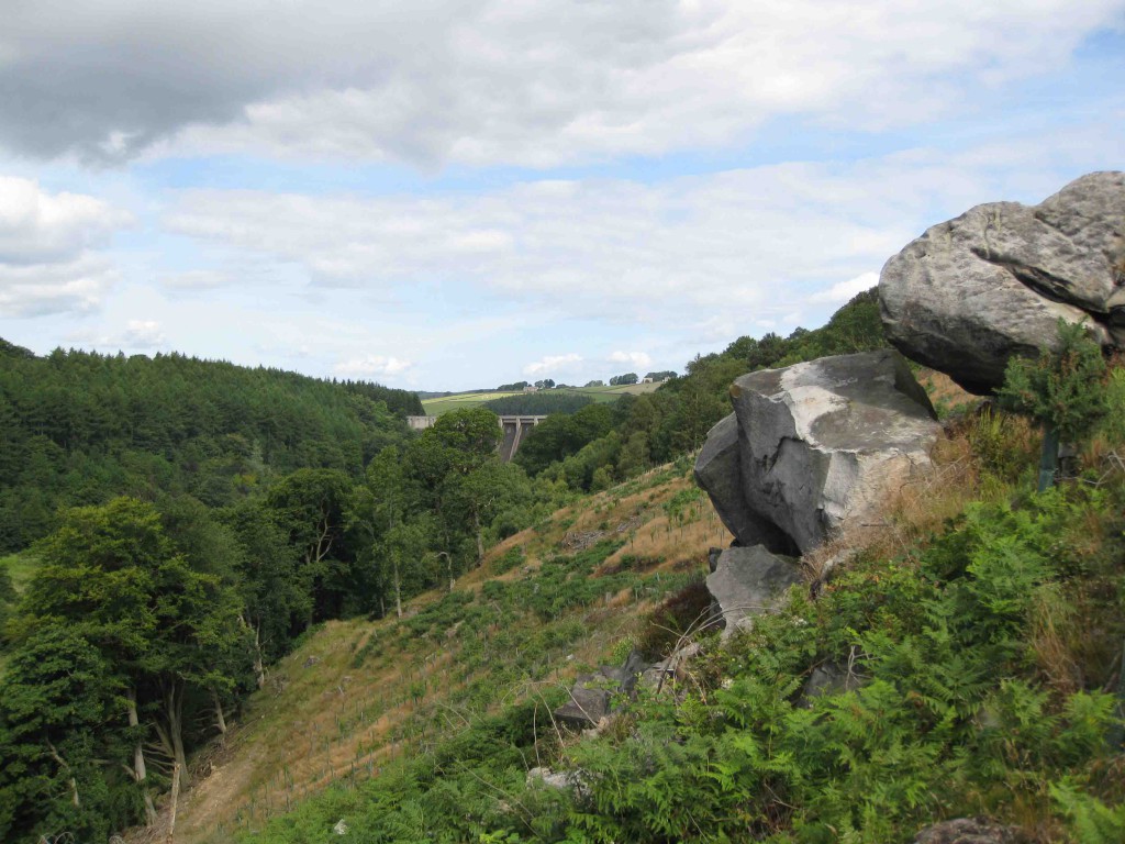
TERRAIN: The area is mix of mature woodland in the Washburn river valley below Thrusscross Reservoir, an area of mature plantation some of which is on a reasonably steep slope, some recently cleared areas and a good expanse of mostly runnable heather moorland with some old quarry workings. There are numerous rock features and some areas of bracken, although courses have been planned to avoid the worst of this as much as possible.
MAP: 1:10,000 scale with 5m contours for all courses. Revised in 2015. Printed on waterproof paper. Control descriptions will be printed on the map and available loose in the start lanes.
COURSES: Colour coded courses:
| White | 1.7km – 55m climb | Easy |
| Yellow | 2.0km – 55m climb | Easy |
| Orange | 2.7km – 100m climb | Fairly easy |
| Light Green | 3.1km – 125m climb | Moderate |
| Short Green | 3.5km – 140m climb | Fairly hard |
| Green | 3.9km – 120m climb | Hard |
| Blue | 5.8km – 215m climb | Hard |
| Brown | 7.1km – 240m climb | Hard |
| Registration open: | 10:00 am – 12:00 noon |
| Starts: | 10:30 am – 12:30 pm |
| Car Park Exit Opens | 12.00 noon |
| Courses close: | 2:00pm |
FACILITIES: The assembly area is adjacent to the car park and there are permanent toilet facilities with running water. Water will be available at the finish.
DOGS: Dogs are allowed, but only in the car park/assembly area and must be kept on a lead at all times.
SAFETY: Competitors take part at their own risk and are responsible for their own safety. If travelling alone, please leave your keys at registration. All competitors who start must report to download even if they retire. Whistles and full leg cover compulsory. Waterproof jackets may be compulsory in the case of bad weather. In the unlikely event of cancellation, details will be posted on the Claro website – www.claro-orienteering.org.uk. Information can also be obtained by phoning the organiser.
RESULTS: These will be posted on the Claro website www.claro-orienteering.org.uk.
PHOTOGRAPHY: In accordance with the British Orienteering Child Welfare Policy and Procedures, the organiser of this event requires that any person wishing to engage in any video, zoom or close range photography should register their details with the organiser before carrying out any such photography. The organiser reserves the right to decline entry to any person unable to meet or abide by the organiser’s conditions. The club policy is here.
OFFICIALS:
Organiser: Vince Grealy (CLARO) – 07958 955334
![]()
Planner: Mark Hewson (CLARO)
Controller: Graham Ramsden (CLARO)