
Dob Park Night Event, Sat Nov 28th
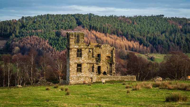
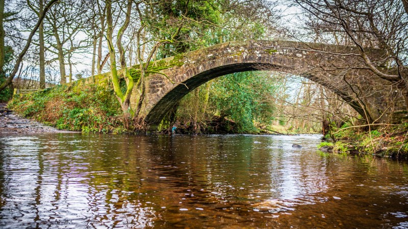
Claro welcomes you to our annual night event, this year being held at Dob Park, on the southern slopes of the lovely Washburn valley and overlooked by Dob Park Lodge. The lodge is an unusual 17th century country house deer park lodge survivor, said to have been shelled by Cromwell’s troops. Dob Park Bridge, on the edge of the map, is a 15th century packhorse bridge, rebuilt in the 18th century. There’s plenty of history and technical challenge to entertain you, and courses for all abilities and levels of experience.
ENTRIES:

To guarantee a map, enter before midnight Sun 22nd Nov. After this, subject to map availability and £2 supplement, entries for all courses will be available online until Thu 26th Nov 5pm, and then at the event for courses L, M and S only. Please note that there will be NO entry at the event for course VS. Enquiries to entries@claro-orienteering.org.uk.
Standard Ts and Cs include that the organisers reserve the right to refuse entry to a course or courses. Dob Park is both physically and technically challenging. Course S is TD3 primarily due to the reduced physical challenge. (Technical Difficult is measured on a scale from 1 easiest to 5 hardest).
Ts & Cs HERE
YHOA Night League: Courses have been planned to match the requirements of the YHOA Night League. Please see the rules for which courses you should enter if competing in this league. These are available at https://www.yhoa.org.uk/yhoa-night-league/. Note that the YHOA Night League has a 90 min time cut-off on all courses, which applies to all competitors whether competing in the league or not.
OTHER INFORMATION
Venue: Dob Park
Location: postcode: LS21 2NA; w3w: cross.operation.pool, OS grid ref: SE196499
Assembly: hard standing parking area off Dob Park Road
Times: 1700-1800: registration open; 1730-1830: start open; 2000: courses close (you must have returned and downloaded by this time). Anybody finishing after this time will count as having not finished.
Facilities: an open fronted barn will be used for download/assemble. Portaloos will be provided.
Courses: Distances are measured ‘straight line’ between controls. Add c 25% for expected running distance and note that there are some steep climbs in the area. Some controls are close to others – please check control codes carefully. 2-sided maps will show the courses continuously, so you choose when to flip the map over.
| Courses | Km (straight) | Climb (m) | Map | Technical Standard |
| Long (L) | 4.0 | 195 | 2-sided | Experienced (Technical Difficulty 5 of 5) |
| Medium (M) | 3.0 | 120 | 2-sided | Experienced but shorter (TD4-5) |
| Short (S) | 2.0 | 50 | 1-sided | Some experience/older beginner (TD3) |
| Very Short (VS) | 1.5 | 40 | 1-sided | Inexperienced/young beginner/family (TD2) |
Start: 350m / 5 min uphill walk: Punching start. Exit the car park entrance, cross Dob Park Road at the marshalled crossing point and proceed up the track. Note that this track is also a route choice option on some courses – please give priority to competitive runners.
Finish: Punching finish. The finish is adjacent to download and the car park.
Courses S and VS – taped route to finish: It is not possible to see the finish from the final control;
please follow the tapes hung in trees to the finish.
All courses – road crossings: All courses cross Dob Park Road when moving from the western to the
eastern parts of the area. This is a dead-end farm road with good visibility in both directions and is not
expected to be busy. VS and S have been planned so that runners cross at a marshalled
road crossing. M and L may cross at either crossing point depending on route choice – the
northern/downhill crossing will not be marshalled. Other than directly crossing, the road is out of bounds
and running up/down the road will result in disqualification. The car parking area is also out of bounds
during your run.
Safety: Whistles are compulsory and may be checked at the start. Some parts of the area are very exposed
– consider carrying a cagoule & spare torch. Runners must report to download before departing the event,
even if they retire.
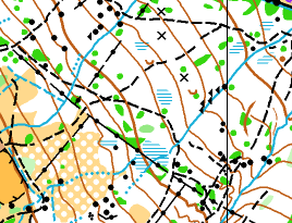
Map: 1:5000/5m contours. Minor map updates made by David Day and Will Drewe for the event
(autumn 2026).
Terrain: Dob Park is a physically and technically challenging embankment overlooking the Washburn
Valley, north of Otley. The forest is mixed in nature with a different feel between the western, and more
runnable eastern parts. There is considerable rock and contour detail to navigate through – grippy/spiked
shoes are recommended. Significant/notable boulders are mapped. Some forest (white) and open/rough
open (yellow) areas of the map, especially in the western part, have infilled with bracken – this is starting to die back and can be navigated through/around where needed, but may not be considered as white/yellow as you may expect. Thickets are generally diffuse in structure and can be indistinct in nature. At the time of writing, the streams and marshes are generally dry but clearly visible on the ground. There are some wind-blown trees which can be easily navigated around when encountered. The eastern section is used for Airsoft combat events resulting in a more extensive and defined path network and some manmade structures, the most significant of which are marked on the map (X – manmade object symbol). Due to the autumnal conditions and low footfall in the area, paths are generally leaf covered and indistinct. All course require crossing Dob Park road to connect the western and eastern forest sections.
Parking: Parking will be on a hard standing car park off Dob Park Road – see location details above.
There is plenty of space so the car park will not be marshalled. Assembly and the finish are adjacent. The
car park is out of bounds during your run.
Public transport: There is no public transport to the area. Please arrange to lift share where possible.
Officials:
Organisers: June Graham & Katie Gray
Planner: Will Drewe
Controller: David Day